The Route
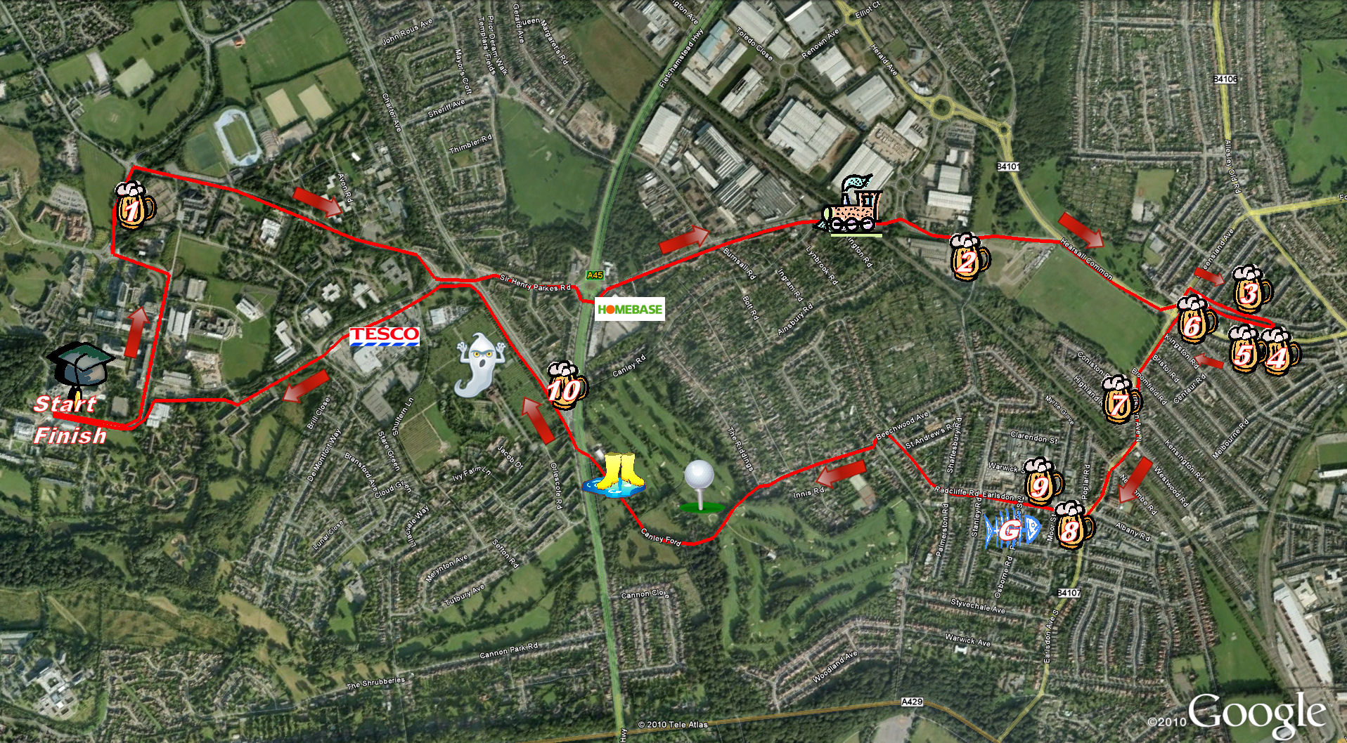
The Route: click on links for Google Maps Street View
- The Bar - Start and Finish
- 1. The Varsity
- 2. The Farm House
- 3. Craven Arms
- 4. Coombe Abbey
- 5. Hearsall Inn
- 6. The Chestnut Tree
- 7. The Old Clarence
- 8. City Arms
- G. Gabriels
- 9. The Royal Oak
- See below for route to Phantom Coach via Canley Ford.
- 10. The Phantom Coach
- Back to The Bar/Union.
The route from The Royal Oak to the Phantom Coach is the trickiest of the Pub Jog (especially given the state of inebriation at that stage), so we include more detail:
Carry on down the High Street (Google Maps)
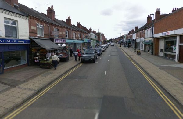
Until you come to some crossroads (there is a church opposite). Turn left. (Google Maps)
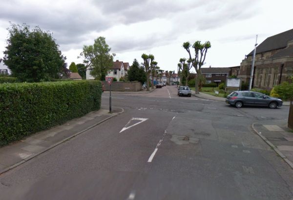
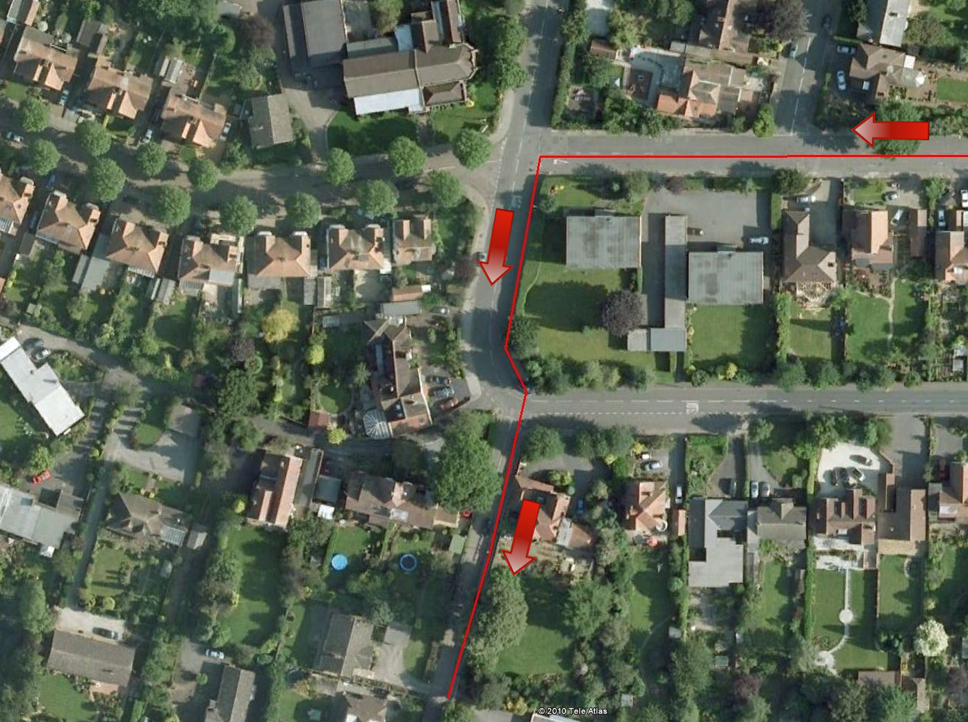
Very shortly the road bends round to the left, you need to cross the road (carefully) and go down the second right (the road with "cul-de-sac" signs at the junction, in the middle of the following photo) (Google Maps)
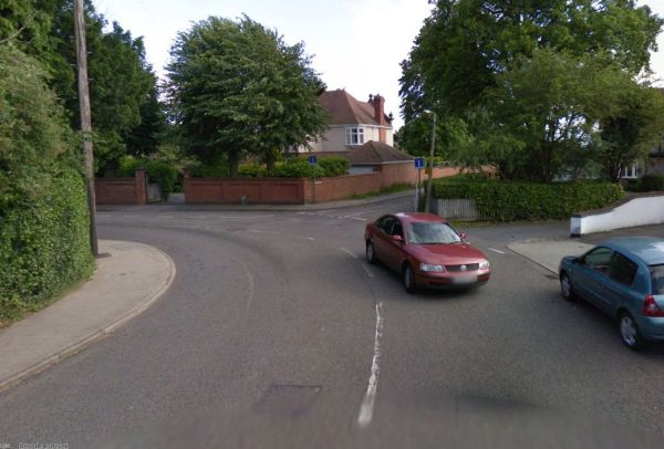
and the route so far from above...
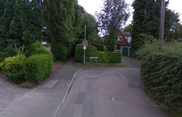
Follow this road down the hill until the road makes a sharp right, at this corner there is a footpath going between two bushes... follow the path (Google Maps).
This takes you past the golf course, after a house on the right the path becomes wider and goes off to the left, instead keep to the right, you will head off towards the ford, passing some concrete bollards and eventually come out by an Esso station... the Phantom Coach is the other side of the main road. The route from the beginning of the path to the Esso station is below:

© University of Warwick Athletics & Cross Country Club
email athletics@sunion.warwick.ac.uk - Pub Jog pages by Dave Wood based on design by Matt Rooke